
Expect 2 to 5 inches of total rainfall, which will cause flash flooding and flooding for western counties. Those along the coast will be spared ...

Expect 2 to 5 inches of total rainfall, which will cause flash flooding and flooding for western counties. Those along the coast will be spared ...
Tropical storm warnings have now been issued by the National Weather Service for every county in New Jersey. Residents will see a myriad of tropical ...
Regardless of the exact track of Hurricane Isaias portions of New Jersey are in line for a significant rain event.
Heavy rains and embedded thunderstorms will be the main impact for most of the New Jersey, while the immediate coastline will experience wind gusts and ...

A brief bout of wintry weather is expected late Wednesday evening into the predawn hours across the northern tier of New Jersey.
A winter weather event is unfolding across New Jersey Saturday morning.
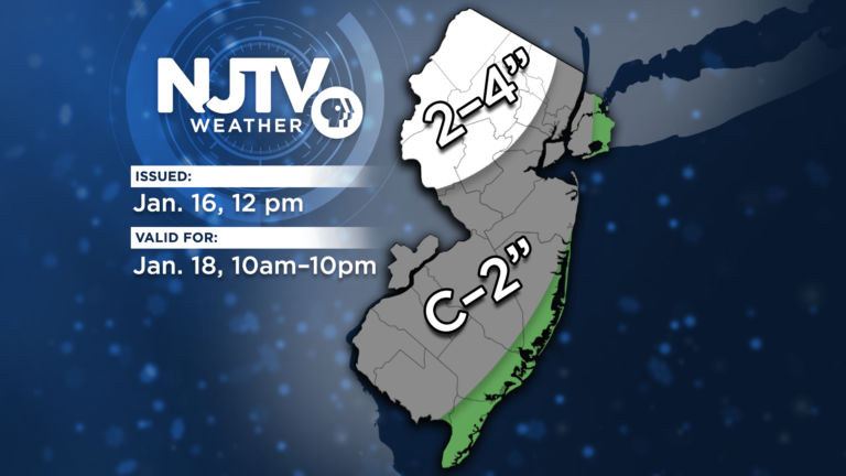
A light to moderate accumulation of snow and sleet is on tap for Saturday as a surface low slides north of New Jersey.
After wintry weather on Tuesday, temperatures will drop into the 20s and teens on Wednesday and Thursday. The week ends with warmer weather with temperatures ...
A significant winter weather event will unfold for northern New Jersey Monday evening, bringing accumulating snowfall and ice accretion.
The weather event may make for some slippery sledding Wednesday for the morning commute.
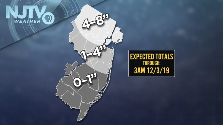
New Jersey's coastal storm is slowly deepening, and slowly sliding east away from the state this Monday evening. NJTV Meteorologist John Cifelli has the weather ...
A dangerous winter weather setup is unfolding across New Jersey. John Cifelli has the weather update.
Meteorological winter continues on Monday, with snow impacting the northern half of New Jersey.
Meteorological winter begins Dec. 1 each year, and on cue parts of New Jersey will enter the new season with snow, sleet and freezing rain.
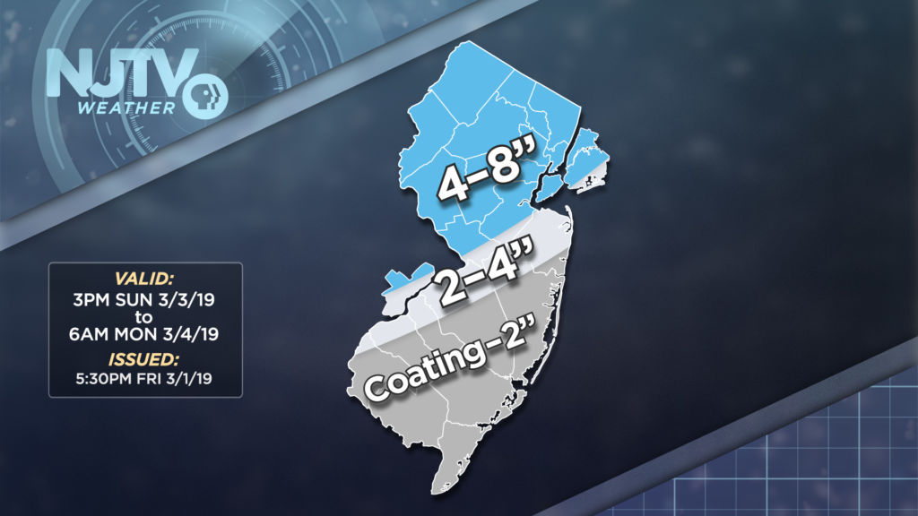
The storm will bring a winter weather impact to the northern half of the state, and southern New Jersey will see mostly rain.
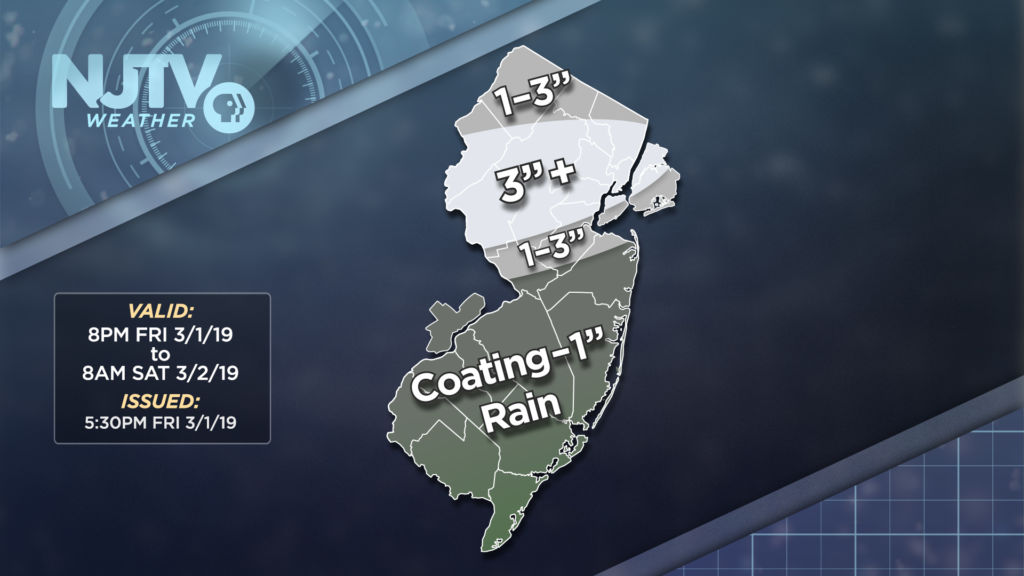
We have more snow and sleet to contend with, as well as anomalous cold thereafter.
Meteorological spring begins March 1, but there are three chances for snow in the first four days of March.

Our midweek winter storm is concluding Wednesday evening, leaving a minor impact on many New Jersey residents and a moderate effect on others.
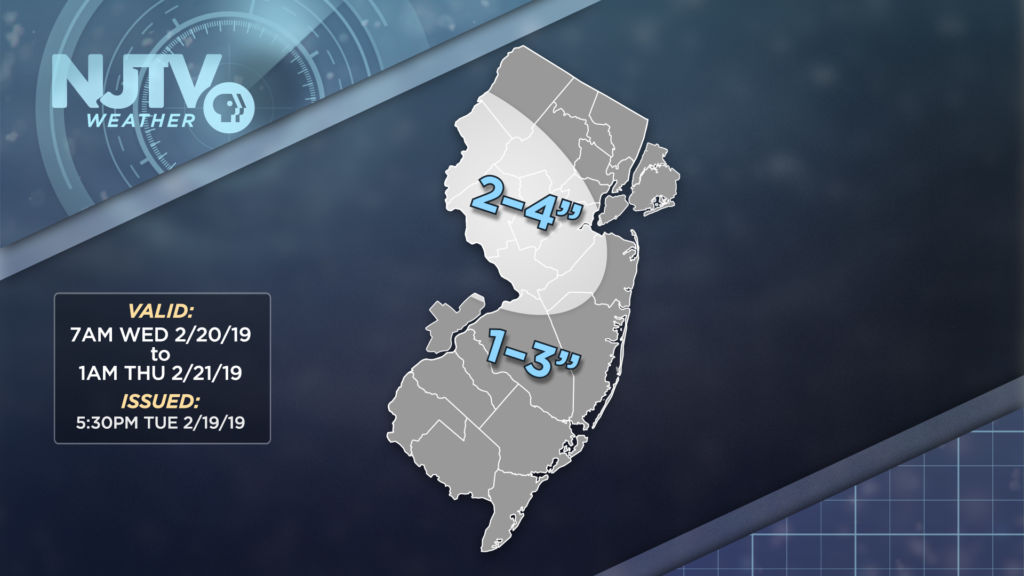
The timing of the heaviest snow and sleet will coincide with the evening drive for millions of New Jersey residents.
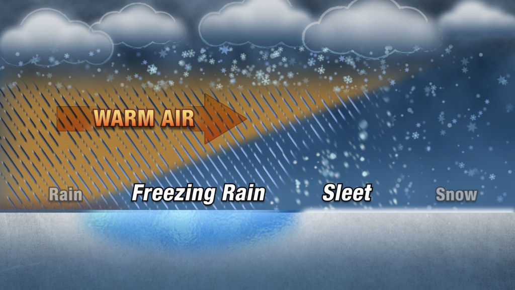
The winter storm is winding down Tuesday evening after having thrown the kitchen sink at New Jersey during the day.