
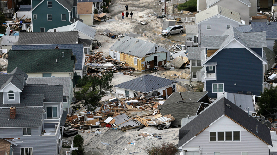
 Credit: (AP Photo/Mike Groll)
Every four years, the federal government is required to gather up the leading research on how climate change is affecting Americans, boil it all down, and then publish a National Climate Assessment. This report, a collaboration between more than a dozen federal agencies and a wide array of academic researchers, takes stock of just how severe global warming has become and meticulously breaks down its effects by geography — 10 distinct regions in total, encompassing all of the country’s states and territories.
The last report, which the Trump administration tried to bury when it came out in 2018, was the most dire since the first assessment was published in 2000. Until now.
The Fifth National Climate Assessment, released on Tuesday by the Biden administration, is unique for its focus on the present. Like previous versions, it looks at how rising temperatures will change the United States in decades to come, but it also makes clear that the rising seas, major hurricanes, and other disastrous consequences of climate change predicted in prior reports have begun to arrive. The effects are felt in every region. In the 1980s, the country saw a billion-dollar disaster every four months on average. Now, there’s one billion-dollar disaster every three weeks, according to the assessment. All of the many extreme weather events that hit the U.S., from the tiniest flood to the biggest hurricane, cost around $150 billion every year — and that’s likely a huge underestimate.
“Climate change is here,” said Arati Prabhakar, director of the White House Office of Science and Technology Policy in the Biden administration during a briefing on the report. “Whether it’s wildfires or floods or drought, whether it’s extreme heat or storms, we know that climate change has made its way into our lives and it’s unfolding as predicted.”
The report outlines steps every level of government can take to combat the climate crisis. And it takes stock of progress that has been made over the past four years. There’s good news on that front: President Joe Biden and Democrats in Congress have managed to pass historic climate measures that are expected to reduce the country’s carbon footprint between 32 and 51 percent by 2035, putting the U.S. closer to meeting its emissions targets under the global climate treaty known as the Paris Agreement. A number of cities and states have passed climate policies that can serve as a blueprint for what actions the rest of the country, and indeed the world at large, needs to take in the coming years. California’s clean car program and the Northeast’s regional carbon cap-and-trade program are two examples.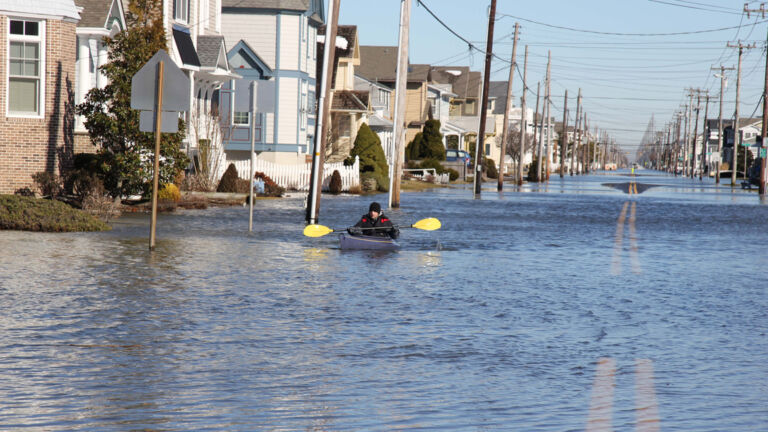
Despite this progress, climate impacts — oppressive heat domes in the Southeast that linger for weeks on end, record-breaking drought in the Southwest, bigger and more damaging hurricanes in the Atlantic basin, wildfires of unusual duration and intensity along the West Coast — are accelerating. That’s the nature of human-caused climate change: The consequences of a century and a half of burning fossil fuels are arriving now. Even if we stopped burning oil and gas tomorrow, some degree of planetary warming is baked in.
This reality, the report says, leaves the country no choice but to adapt, and quickly. “We need to be moving much faster,” the Biden administration said. “We need more transformative adaptation actions to keep pace with climate change.”
The Grist staff, located all over the country, reviewed the assessment to provide the most important takeaways region by region. Here are their takeaways on three regions.
Northeast: Rain and floods
Connecticut, Delaware, Maine, Maryland, Massachusetts, New Hampshire, New Jersey, New York, Pennsylvania, Rhode Island, Vermont, Washington, D.C., West Virginia
When it comes to climate-fueled flooding, the 67 million residents of the U.S. Northeast are especially at risk, and the region’s aging stormwater and sewage infrastructure only makes matters worse. This summer, historic flooding in New York, Vermont, and Massachusetts killed multiple people and caused hundreds of millions of dollars in damage, a preview of flooding-related dangers to come. Extreme precipitation events have increased 60 percent across the entire region, which the report says could be due to a combination of more tropical storms and a warmer, wetter atmosphere. No other region in the U.S. has seen such a marked increase in rainfall.
But climate impacts within the Northeast extend far beyond flooding. Days when real-feel temperatures are over 100 degrees Fahrenheit will triple by 2050 under an intermediate warming scenario, the report said, and communities that lack access to reliable and affordable air conditioning will see their health and general well-being decline as a result.
The report also warns that states along the coast will have to confront the effects of warming water on marine species, fish stocks, and tourism — if they aren’t doing so already. In the Gulf of Maine, for example, lobster, oysters, and other shellfish are expected to decline. Animals that can migrate, such as right whales, will abandon the gulf for cooler waters north of the state. Sea bass, some types of squid, and other temperate marine species, on the other hand, will flourish. Warming winter nights are allowing damaging forest pests, such as the emerald ash borer and the woolly adelgid, to extend their ranges into colder latitudes and plague new ecosystems.
Rising seas along the coastline will push homes and infrastructure inland, raising the controversial question of who gets to leave and who can stay. Already, home buyout programs and multibillion-dollar flood protection initiatives are underway in New Jersey and New York. — Zoya Teirstein
Southeast: Monster storms
Alabama, Arkansas, Florida, Georgia, Kentucky, Louisiana, Mississippi, North Carolina, South Carolina, Tennessee, Virginia
The sunny and fast-growing Southeast is on a collision course with climate change. Its cities have gobbled up more than 1.3 million acres of exceptionally biodiverse land since 1985, and more than a million people have moved to Florida alone since 2018. These newcomers are sitting ducks for worsening disasters, especially floods. The Southeast has seen almost two dozen hurricanes make landfall since 2018, and these monster storms are ballooning to full strength much faster as they cross a hotter Gulf of Mexico. The slow creep of sea-level rise has also led to more frequent tidal flooding in coastal cities like Miami. That’s bad news for the millions of people who have bought waterfront homes over the past few decades.
To say the region is ill-prepared for this era of climate disaster would be an understatement. Many Southeastern cities are plagued with flimsy manufactured housing, antiquated drainage systems, and decades-old power grids. Heat stroke will become a bigger danger for outdoor workers, and more blackouts will knock out life-saving AC units in big cities. Louisiana saw more than 20 such events between 2011 and 2021. Warmer spring temperatures will also increase pollen counts in cities like Atlanta, worsening air quality. All these impacts will be more dangerous for the region’s Black residents, who live in hotter and more flood-prone places than their neighbors.
The region’s declining rural areas also face existential threats, as industries find themselves unprepared for a warmer world. Farmers of cash crops such as citrus and soybeans, for instance, are fighting a four-front war against drought, flooding, heat, and wildfires, which all reduce annual yields. Extreme weather will continue sapping these moribund economies, leading to more out-migration and urban growth. — Jake Bittle
US Caribbean: Economic and social vulnerabilities
Puerto Rico, U.S. Virgin Islands
The climate impacts facing Puerto Rico and the U.S. Virgin Islands don’t differ wildly from those of the continental states: Storms will strengthen, coastlines will shrink, temperatures will rise, and rainfall will diminish.
What’s distinct about how the U.S. Caribbean territories will experience these hazards (apart from the islands’ location in a hurricane-prone ocean) are the economic and social conditions that have already made the region’s disasters more deadly — conditions that can be traced to the territories’ history as de facto U.S. colonies. More than 40 percent of Puerto Rico’s 3 million residents live below the poverty level, as do almost 20 percent of the 87,000 people living in the U.S. Virgin Islands.

That resource imbalance also shows itself in the dearth of necessary data available to assess current and future climate impacts in the region, especially in the U.S. Virgin Islands. The report is full of footnotes conceding that data was unavailable for the Caribbean territories.
Without improved social and economic resilience, U.S. Caribbean residents will continue to be uniquely vulnerable to storms, floods, and heat.
“We may be facing more extreme hurricanes, but if we have the capacity, the quality of life, the social conditions to be prepared, it wouldn’t be that catastrophic,” said Pablo Méndez-Lázaro, lead chapter author and associate professor of environmental health at the University of Puerto Rico. “If we keep having a huge amount of people living under the poverty level, with preexisting conditions, exposed to flood areas, we will face another María.” — Gabriela Aoun Angueira