
 Credit: (AP Photo/Wayne Parry)
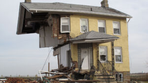
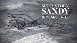 It is clear that much of New Jersey’s coastal landscape was altered permanently 10 years ago, on Oct. 29, 2012, when Superstorm Sandy barreled into the state, killing 38, damaging or destroying over 346,000 homes, and causing $30 billion in economic damage.
The change, however, has hardly been uniform.
“There’s a spectrum,” said Peter Kasabach, executive director of New Jersey Future, a nonprofit that focuses on land-use planning and policymaking in the state. “Some people just feel like we’re going to have more water, and we’re just going to have to live with it; other people are in denial and thinking, ‘Well, that won’t happen again’; and then some people are very concerned for not just their own well-being but realizing that the kind of decisions that need to be made are societal decisions that are going to affect whole communities.”
In urban communities like Hoboken, Jersey City and Weehawken, Sandy’s fingerprints are not in new homes and buildings but in innovative infrastructure purpose-built for higher storm surges and heavier rainfall. In suburban and rural communities along the Raritan River and Delaware Bay, Sandy’s legacy is razed neighborhoods whose footprints, year by year, vanish farther beneath nature. On the Jersey Shore, where the storm’s damage was most severe and future flood risk is most acute, development has exploded and expanded into perilous territory.
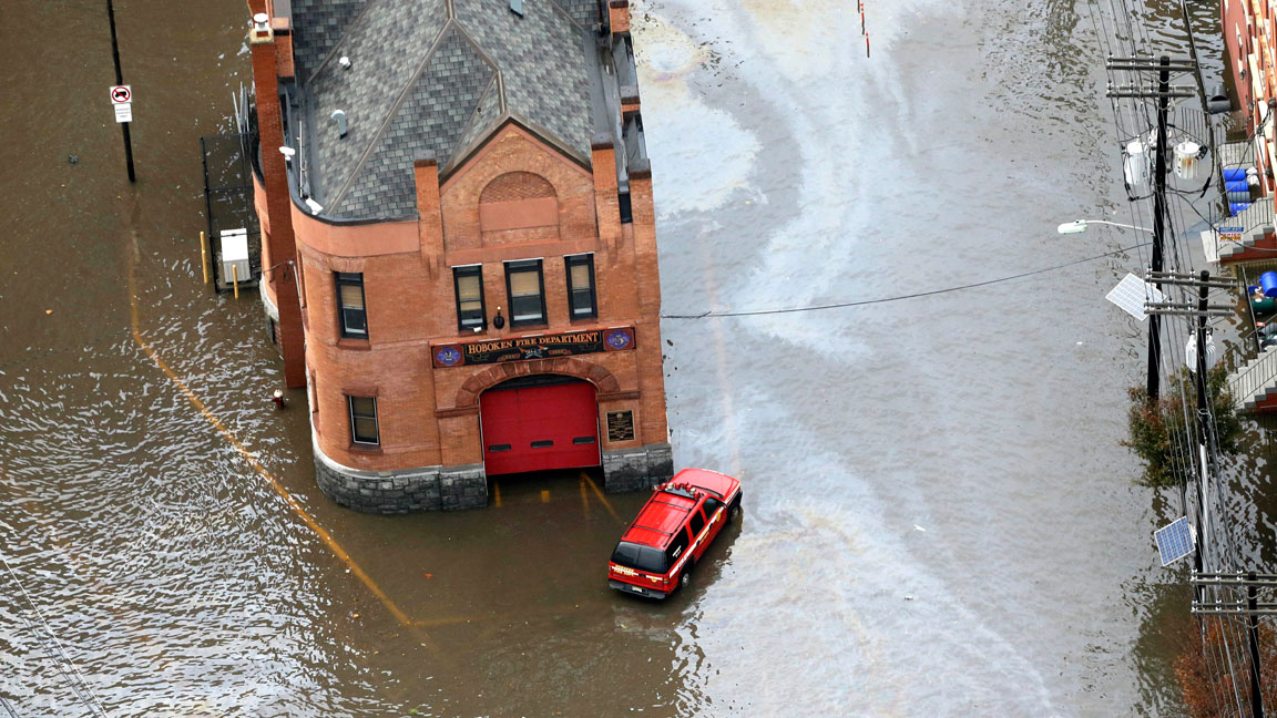
No New Jersey city was hit harder than Hoboken. A record-breaking 14-foot storm surge spilled from the Hudson River into the low-lying city, causing $100 million in damage. Municipal property alone suffered $10 million in damages. For the centuries-old city and its historic homes, buildings and infrastructure, Sandy was a wake-up call to the realities of climate change.
 Credit: (AP Photo/Mike Groll, File)
In June 2013, the U.S. Department of Housing and Urban Development launched its Rebuild by Design competition, which awarded federal dollars to Sandy-impacted communities that developed innovative storm and flood resilience plans. Hoboken was among the first New Jersey municipalities to participate.
How Hoboken responded
The challenge for the city, said Tom Herrington, the associate director of Monmouth University’s Urban Coast Institute, was how to implement big changes in a place where it would be extremely difficult to do so.
“These are old buildings, they’re not being replaced by new buildings on pilings like they are at the Jersey Shore,” Herrington said. “The character of the community and its infrastructure predisposed it to kind of stay the same.”
Which is why, Herrington continued, the Rebuild by Design competition was so crucial to Hoboken’s impetus to become a more resilient city.
Many of Hoboken’s resilience projects won’t be noticed unless you know what you’re looking for. On the Jersey Shore barrier islands, however, the evidence is staggeringly clear and ubiquitous.
In 2014, Hoboken, Jersey City and Weehawken were awarded $230 million to begin work on the Rebuild by Design-Hudson River project. (The State of New Jersey later contributed an additional $100 million.) The project was built on a strategy of resist, delay, store, and discharge. Traditional hard infrastructure, like seawalls, pumping stations, building code updates, and decoupling sections of the city’s combined sewer system are joined with Dutch-influenced green infrastructure like rain gardens, permeable surfaces and updates to parks and other open spaces to improve their ability to soak up and store stormwater.
The pumping stations and much of the green infrastructure have been completed while the larger elements of the project, like combined sewer decoupling are estimated to be done in 2026. When complete, the Rebuild by Design-Hudson River project will be the kind of initiative that will have dramatically altered Hoboken’s flood resiliency without altering its built and cultural landscape, said Caleb Stratton, the city’s chief resilience officer.
Wake-up call
“I would say that the most significant change in the community has been the awareness of the flood risk issues, the complexity of those issues and the investments that the city has to make,” Stratton said. “If you weren’t from Hoboken, you’d say that’s a nice park. But because you live in Hoboken, you’re like, I’m glad that provides stormwater benefits.”
 Credit: (AP Photo/Wayne Parry)
Herrington said that Sandy was a wake-up call for not just Hoboken, but coastal cities everywhere.
“I don’t think we had that appreciation for how vulnerable our urban coasts were to storm surge damage,” he said. “That was a real lesson learned from Sandy.”
As Stratton pointed out, many of Hoboken’s resilience projects won’t be noticed unless you know what you’re looking for. On the Jersey Shore barrier islands, however, the evidence is staggeringly clear and ubiquitous.
It begins with beach replenishment. Over the past three decades, nearly $2 billion has been spent on beach replenishment projects.
Beach replenishment, improved infrastructure
Almost every foot of oceanfront from Cape May to Sea Bright has been augmented by the Army Corps of Engineers. The cost of regularly scheduled replenishment projects is shared by the municipal, state and federal government, the latter covering 65% of the price tag, but the emergency work done in the wake of Sandy was covered entirely by the federal government.
 Credit: (AP Photo/Patrick Semansky)
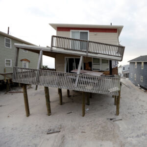
On the other side of their beaches, most barrier island towns have also been feverishly spending tens of millions of dollars on infrastructure improvements directly related to flooding and storm damage mitigation.
Ocean County’s Long Beach Island stretches for 22 miles, is only 0.75 miles across at its widest point and is carved out by six different municipalities. It was one of the hardest-hit barrier islands during Sandy. But extreme weather is hardly the only risk: As it does on the other Jersey Shore barrier islands, flooding visits Long Beach Island’s streets and yards on most full and new moon cycles, during every heavy rainfall, and even when strong winds blow from the north and northeast.
Long Beach Township is the largest of the six municipalities on the island. Long Beach lost three water plants that were inundated by Sandy’s storm surge and it took seven years to rebuild them all, said the township’s mayor, Joe Mancini. Other water infrastructure, along with sewer, gas and electrical systems had to be replaced.
At the local level, there was an incentive for planning and zoning boards to encourage the demolition of older, smaller housing stock to make way for new construction with far more square footage.
“[Over] much of the last ten years, we replaced probably eighty percent of our infrastructure,” said Mancini, who estimates that the township has spent about $100 million to both repair damaged infrastructure and install new, like pumping stations.
But because infrastructure work like this is conducted almost exclusively during the offseason in the barrier island resort towns, summer tourists are often oblivious to its existence. Come Memorial Day, streets that have spent the winter split open and gorged with new infrastructure designed to better withstand the next Sandy, have been repaved, often several inches higher than before, and painted with fresh lines.
Breakneck development at the Shore
What year-round residents and tourists alike can see in stark relief, however, is the breakneck pace of development.
Federal rules, administered through Federal Emergency Management Agency, require any home that sustains damage greater than 50% of its value to be rebuilt to the new, post-Sandy standards, which include much higher — and expensive — elevation requirements. On top of that, flood insurance rates were increasing with every major disaster that hit the U.S.
“Even homeowners that had flood insurance came to the realization that they didn’t have enough money to rebuild,” said Herrington. “In some cases, they sold their property rather than taking out more loans and investing in the property.”
 Credit: (AP Photo/Julio Cortez)
At the local level, there was an incentive for planning and zoning boards to encourage the demolition of older, smaller housing stock to make way for new construction with far more square footage. This mentality wasn’t exactly driven by an awakening to the fact that their near future will involve higher tides, bigger storm surges, and more extreme weather. Yes, new, elevated homes would be more resilient, but the real incentive was that bigger homes meant bigger ratables.
“Rebuilding to higher standards costs more money,” said Herrington. “You’re looking at a different demographic that can afford to do that.”
The pandemic only intensified this trend. In each of the 42 municipalities that occupy the state’s barrier islands, home prices have soared by 75% since Sandy — and especially since 2020, when would-be part-time visitors were suddenly able to live at the Shore full-time.
Soaring prices, wealthier residents
At a 67% increase, Long Beach Township, already mostly the domain of the affluent before Sandy, represents a modest increase compared to other Shore municipalities. In Cape May County’s Sea Isle City, for example, the average home price has increased 131%, from $571,441 in 2013 to $1,319,913 in 2022, according to the New Jersey Division of Taxation.
In 2010, Long Beach had 9,216 housing units; today, it has 8,832, according to the New Jersey Department of Community Affairs. On the ground, this 4% contraction is largely the result of the tearing down of older structures that, in many cases, reflected the island’s modest, blue-collar beginnings.
“After Sandy, most of the damaged homes were Cape Cods and duplexes that were built in the fifties, sixties and early seventies,” Mancini said. “And the duplexes that were ripped down were replaced by single-family homes.”
These new homes are hardly modest, said Mancini, whose family business was one of the earliest to build and sell homes throughout Long Beach Island.
‘I think we’re seeing that idea of ‘becoming a playground of the rich’ playing out in what can appear to be slow motion.’ — Peter Kasabach, New Jersey Future
“In the fifties, sixties and seventies, you had a three-bedroom, one-bath home, and all the relatives would come down and the kids would sleep on the porch in sleeping bags,” Mancini said. “Today, if everybody doesn’t have an en suite bathroom, air conditioning and Wi-Fi, the kids won’t come down. So, a family of three has morphed from a 1,000-square-foot house to a 2,700-square-foot house. That’s just the way it is.”
Mancini also pointed out that many of the post-Sandy home purchases in Long Beach Township have been made in cash. Homeowners who have paid off their homes aren’t required to purchase flood insurance. Without polling homeowners one by one, it is hard to get a picture of how many of the new, larger homes on the Jersey Shore that have been paid for in cash are without flood insurance. But, what is clear is that most homes in the four counties that encompass the Jersey Shore — Cape May, Atlantic, Ocean, and Monmouth — do not have flood insurance.
Flood insurance?
According to Milliman, an actuarial firm that studies the impacts of climate change on flood insurance, only 47% of people living in flood zones in these counties have coverage. Ocean County, where Long Beach Island is located, has the highest rate of coverage, but even that is only 59%.
“I think we’re seeing that idea of ‘becoming a playground of the rich’ playing out in what can appear to be slow motion,” Kasabach, of NJ Future, said. “And, in some ways, disasters accelerate that, because in towns where you might already have been seeing this, places are getting more expensive, people were tearing down houses and putting up bigger houses.”
The booming development of the Jersey Shore, Kasabach pointed out, is in stark contrast to what is unfolding on New Jersey’s other shores.
“In some places we have rebuilt, and in others we haven’t,” he said. “What you’re seeing is that decision-making hasn’t followed, necessarily, scientific protocol; it has generally followed wealth. That’s not really the way we should be making land use decisions in New Jersey — it’s certainly not a fair way.”
A different story on Delaware Bay
From the Delaware Bay hamlets in rural Cumberland County to the riverine communities of Middlesex County, homes were also inundated and destroyed by Sandy’s historic surge.
 Credit: (Andrew S. Lewis)
In the wake of Sandy, the state Department of Environmental Protection revived its then 17-year-old floodplain acquisition program, Blue Acres. The program had purchased a modest number of flood-prone homes throughout the state, but when it was allocated $300 million in federal disaster aid after Sandy, the department announced it would target about 1,000 homes to purchase at pre-Sandy values from willing sellers. After they were acquired, the homes were to be demolished and the land allowed to be rewilded to become flood buffer zones. (As of today, the program has made offers on 1,134 homes, closed on 800, and demolished about 650.)
‘One challenge was overcoming that sense of loss that people in the community felt.’ — Brooke Maslo, Rutgers University ecologist
Almost immediately, the bulked-up program found willing sellers in Cumberland County’s Delaware Bay hamlets and in Middlesex County’s Woodbridge, South River, East Brunswick, and Sayreville communities, among other locations.
The first homes in Woodbridge were demolished in 2015. One of the largest acquisition areas was the Watson-Crampton neighborhood, which abuts the Woodbridge River. That same year, Rutgers University ecologist Brooke Maslo proposed a restoration plan to Woodbridge officials who, up to that point, were not quite sure what to do with all the open space that had suddenly opened up in the neighborhood.
“One challenge was overcoming that sense of loss that people in the community felt,” said Maslo. “We looked at it as a question of, how do you turn this into a public asset, or a destination, that people want to go to? There’s so much potential in these parcels for flood mitigation, and just mowing the grass doesn’t really do much for increasing water storage.”
In Woodbridge, homes replaced by open space
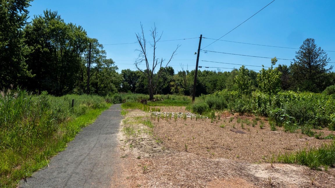
Maslo and her team got to work in 2016. They removed about a half-mile strip of roadway where there were no longer any homes. They planted native meadow grasses, then expanded to drier areas in 2017, where they planted native trees and shrubs. They also rehabilitated a natural drainage swale that had been redirected in the 1950s to accommodate space for development by creating a series of pools that can better hold and drain floodwater. More recently, they’ve installed about a mile of trail that includes interpretive signs to educate visitors on the project and its history.
‘You’re not going to change human nature overnight, so we still have to be lining up those incentives and disincentives better so that we can make better long-term decisions.’ — Peter Kasabach, New Jersey Future
Maslo pointed out that, currently, there is no guidance for municipalities from the Blue Acres program or other state or federal agencies on how to utilize open space once homes have been demolished.
 Credit: (Shelley Kusnetz)
Nor is there money; even after taking the hit to their ratable base, the municipalities are also on the hook for the maintenance of vacant parcels. Maslo argues for an integrated approach that might look like the local-state-federal beach replenishment partnerships at the Shore. With dedicated, long-term investment, she said, municipalities might be able to transform seemingly unusable floodplains into destinations that boost community well-being and even attract visitors.
“On a nice day, you’ll see bike riders and dog walkers and people just out for a walk,” Maslo said of the Watson-Crampton project area. “It’s used quite a bit.”
The past disappears on Money Island
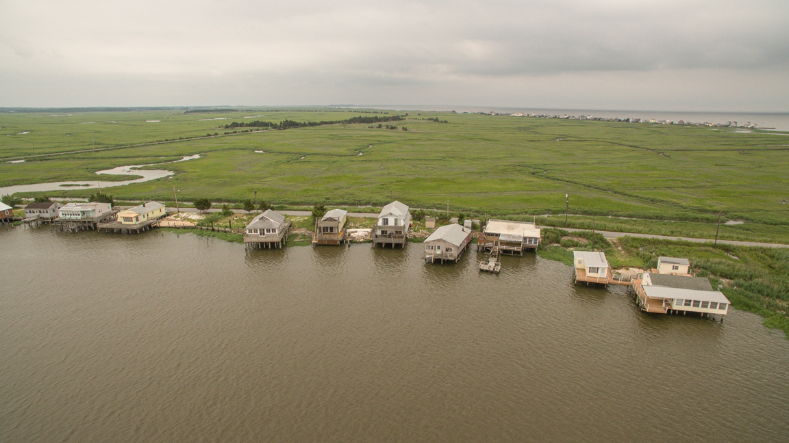
A similar transformation is underway in the Money Island hamlet of Cumberland County. Long before Sandy’s 12-foot surge arrived, homes along the Bayview Road section of the Delaware Bayshore outpost sat over the water, the shoreline beneath their pilings rapidly eroding away.
 Credit: (Andrew S. Lewis)
In early 2019, Blue Acres demolished the last of the homes on Bayview Road, and, in September 2021, the DEP used sand dredged from a creek adjacent to Money Island to build up the shoreline where the homes once stood. A new dune line was planted with beach grass. Just offshore, a series of small rock breakwaters were set. A year later, the shoreline has morphed naturally with the tides, growing in some places and creating tidal pools in others. The asphalt of Bayview Road has almost completely vanished beneath the sand.
“The buyout is not the end of the story,” said Maslo, reflecting on the cultural and ecological opportunities that come with rewilded floodplain like those in Woodbridge and Money Island. “There’s so much more to be done.”
 Credit: (Andrew S. Lewis)
New Jersey Future’s Kasabach agrees that Blue Acres has been a successful initiative, and one that is staring down the coming decades with clear eyes. But, he pointed out, the program will never gain traction in places like the Shore, where property, no matter how imperiled, is only becoming more valuable for developers.
As Mancini, Long Beach Township’s mayor, put it: “We have ratables of over twenty billion dollars. I mean, where the hell are you going to get twenty billion dollars to buy everybody out?”
In the end, how New Jersey changes as flooding worsens and the statistical chance of another Sandy draws nearer is dependent upon how New Jerseyans themselves change — an evolution that likely will be neither singular nor binary, but multifaceted and complex.
“You’re not going to change human nature overnight, so we still have to be lining up those incentives and disincentives better so that we can make better long-term decisions,” Kasabach said. “It’s going to take some time to change the way we do things.”

